Official Project Title:
3-D GIS Visualization of Fort Washington Office Park Improvement Study
Completed 2008
Related Project: Fort Washington Area Flooding and Transportation Improvement Study
Temple University, along with Philadelphia University, Villanova University, Ben Franklin Technology Partnership, Delaware Valley Green Building Council, and other partners, formed the Pennsylvania Green Growth Partnership, funded by Pennsylvania Department of Community and Economic Development. The mission of this partnership is to bring together academic resources from the state of Pennsylvania to foster economically and environmentally sustainable business in Pennsylvania related to the building and construction industries.
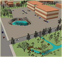
As a founding member of the partnership, the CSC completed a 3-D GIS visualization project, closely tied with another CSC project - Fort Washington Area Flooding and Transportation Improvement Study. As the Fort Washington Office Park is prone to severe flooding, it was important to conduct an analysis in the context of the watershed’s topography, hydrology, and geology in order to avoid the mistake of developing site improvements based on an isolated analysis.
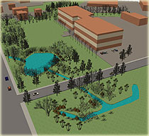
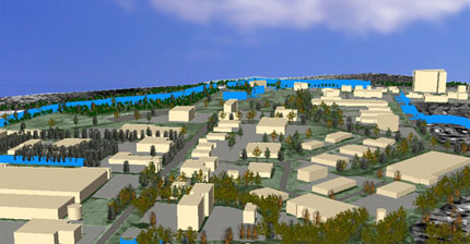
To do this, the project team used GIS as a significant support tool for performing an integrated analysis. The GIS technology provided a means to assemble data and to create map layers representing all the information relevant to conducting such tasks as hydrologic modeling, assessing stormwater impacts of streets, parking lots and sidewalk systems, testing locations for siting BMPs and developing visual images. From this integrated analysis, the project team developed design modifications consistent with Low Impact Development, “Green Streets” and Sustainable Design principles.
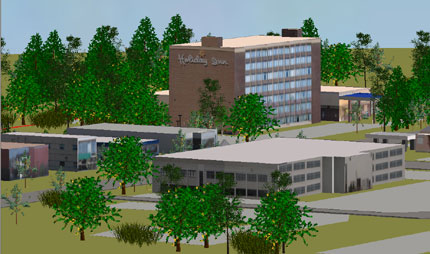
The integrated design charette enabled better understanding on the issues of water, traffic, and architecture simultaneously, in order to recommend new layouts and conceptual proposals to guide future construction in the Office Park. The project team fully developed its GIS and 3-D analyses of alternatives to the current Office Park layout. Illustrating vivid and contrasting alternative and sustainable approaches to the flooding and transportation problems will greatly improve public acceptance and economic support for future projects. The project team will train undergraduate and graduate students in developing these design alternatives and conduct planning studios as part of our academic offerings at Temple and Philadelphia Universities.