Flood Management Studies in Ambler
Status: Completed 2014
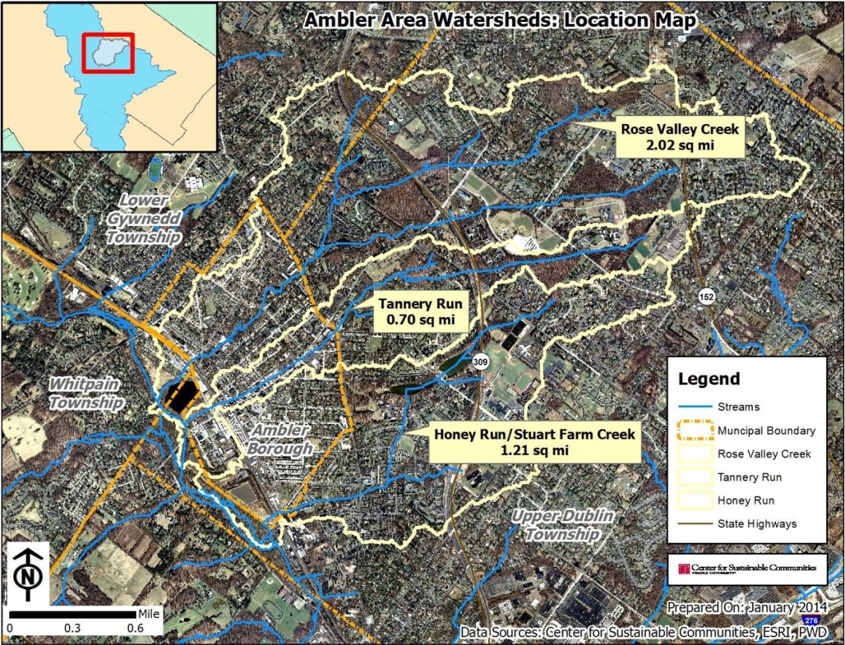
The CSC has developed a stormwater management plan for three urban watersheds that drain several municipalities in southeastern Pennsylvania, including the Borough of Ambler, and the Townships of Lower Gwynedd, Upper Dublin, and Whitpain. The plan has identified and prioritized stormwater improvements to mitigate (i) water quality problems, derived primarily from non-point source pollutions, and (ii) flooding problems that lower-income and minority residents have been facing for many years.
The project team, consisting of researchers at the CSC, formed partnerships with local governments, environmental groups and community organizations. Specific tasks included field data collection and verification, modeling, stormwater management facilities inventory and an assessment of stormwater improvements, including their impact on water quality and flood hazard mitigation, and their implementation strategies. The project developed new preliminary floodplain maps and a high quality GIS database that are now available to township engineers and other interest groups. Implementation strategies included cost estimation and possible funding sources so that municipalities can take actions following the priority list.

Parts of this study were funded by the following municipalities and government agencies:
- Ambler Borough, Upper Dublin Township, and Whitpain Township
- US Army Corps of Engineers (ACE)
- US Department of Environmental Protection Agency (EPA) – Urban Waters Small Grant
- US Department of Housing and Urban Development (HUD) – Community Development Block Grant 1.1
Links: