Official Project Title:
Sandy Run Watershed Floodplain Mapping Study
Completed December 2008
The maps produced in this project can be found in the Fort Washington Area Flooding and Transportation Improvement Study
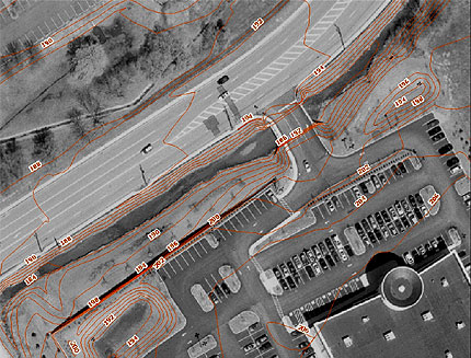
The CSC underwent a fourteen month study to model flooding in the Sandy Run Watershed and prepare new floodplain maps for submission to the Federal Emergency Management Agency (FEMA). Flooding has seriously hampered economic development in the Fort Washington Office Park and the Borough of Ambler (Montgomery County, PA). Unless these problems are addressed and ameliorated, wise development of these areas will continue to languish.
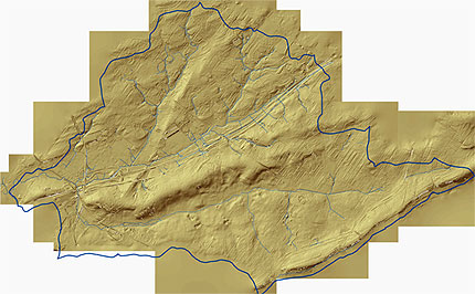
The study, funded by a $200,000 grant from FEMA, included the following outputs: hydrologic/hydraulic modeling, new floodplain maps for the watershed, twofoot digital contour coverage for the watershed, and a Digital Elevation Map (DEM) based on 2005 aerial photography. The study also included an evaluation of existing stormwater management facilities in the area, and field verification of flood elevations and stream obstructions. An engineering evaluation was also conducted of the transportation and water and sewer systems in the watershed areas and their impact on flooding.