Pennypack Creek Watershed Study
Completed August 2006
Executive Summary (pdf)
Full Report - Pennypack Creek Watershed Study (pdf)
Appendices
- Appendix A: Hydrologic Modeling Methodology (pdf)
- Appendix B: Water Quality Studies (pdf)
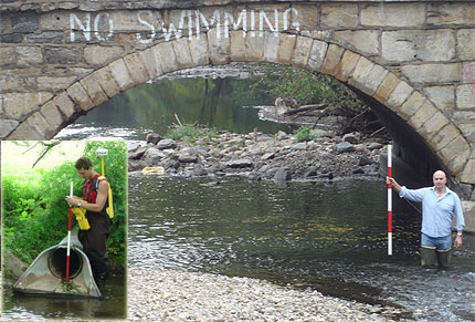
- Appendix C: Field Observations (pdf)
- Appendix D: Open Space and Trail Recommendations (pdf)
- Appendix E: Municipal Floodplain Ordinances Summary Table (pdf)
- Appendix F: Municipal Stormwater Ordinances Summary Table (pdf)
- Appendix G: Model Stormwater Management Ordinance (pdf)
The Philadelphia Inquirer has published an interative map showing the existing and few floodplain maps in the Pennypack Creek Watershed.
Related Project: Act 167 Plan for the Pennypack Creek Watershed
The CSC undertook the Pennypack Creek Watershed Study to help alleviate flooding and pollution in a 12-municipality area that encompasses parts of Philadelphia, Montgomery, and Bucks counties. The study was funded predominantly by a $330,000 grant from the William Penn Foundation, a $192,500 grant from the Federal Emergency Management Agency (FEMA), and a $100,000 from the participating municipalities.
The CSC’s study provided an updated set of floodplain maps for the watershed. University experts also conducted water-quality monitoring in addition to providing municipal officials with better technical information to implement open space and stream corridor protection plans. Researchers have also evaluated existing stormwater facilities to identify modifications that could help mitigate flooding problems.